SUMMARY
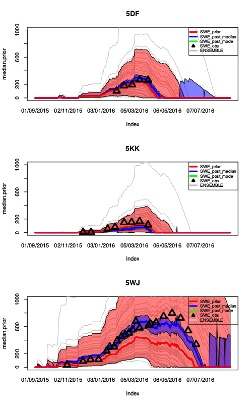
The mountain cryosphere is undergoing significant changes globally, yet these changes are in many cases poorly constrained, particularly in remote regions where data is sparse. Effects of environmental change in mountain regions can generate significant impacts both locally and downstream, therefore dynamics of the cryosphere are important to quantify and monitor. The aim of this project is to assess to what extent we can improve the performance of a new high-resolution modelling scheme in data-poor mountain regions by using techniques to assimilate available observations (e.g. from satellite platforms). Additionally, we will systematically evaluate uncertainties in the modelling process, which will allow us to generate simulation-based probability distributions and communicate results in a more informative form than traditional deterministic methods. Our new scheme will be tested for the case of both permafrost and snowcover in: (A) ‘data-rich’ European Alps and (B) ‘data-poor’ Himalaya, in order to benchmark improvements in the new scheme, due to assimilation of observations. The end goal is a large-scale subgrid modelling scheme that is capable of assimilating available observations and quantifying uncertainty. This project will provide an important toolset to help improve our understanding of dynamics in the cryosphere of remote high-mountain regions. Finally, we will apply these new methods in two contrasting climate regimes in the Indian and Nepalese Himalaya to generate a first combined transient snowcover/permafrost map with strong potential for upscaling both regionally and globally. If successful, the techniques developed in this project could be usefully incorporated into the research and operational avalanche forecast model SNOWPACK at the WSL Institute for Snow and Avalanche Research (SLF) as well as form an important part of an international effort in modelling of the cryosphere at subgrid scales.

